Home > Animals > Birds > Gruiformes > Rallidae > Water Rail
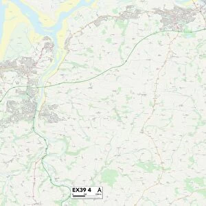
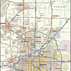
MA Worcester Oxford Vector Road Map

![]()
Wall Art and Photo Gifts from Fine Art Storehouse
MA Worcester Oxford Vector Road Map
MA Worcester Oxford Vector Road Map. All source data is in the public domain. U.S. Census Bureau Census Tiger. Used Layers: areawater, linearwater, roads, rails, cousub, pointlm, uac10
Unleash your creativity and transform your space into a visual masterpiece!
Frank Ramspott
Media ID 20691731
© Frank Ramspott, all rights reserved
Auburn City Map Computer Graphic County Digital Composite District Geographical Border Massachusetts Oxford Road Map Texas Text Vector Worcester Digitally Generated Image Federal Hill Fort Hill Rochdale
FEATURES IN THESE COLLECTIONS
> Animals
> Birds
> Gruiformes
> Rallidae
> Water Rail
> Animals
> Mammals
> Cats (Wild)
> Tiger
> Arts
> Landscape paintings
> Waterfall and river artworks
> River artworks
> Arts
> Portraits
> Pop art gallery
> Street art portraits
> Arts
> Street art graffiti
> Digital art
> Digital paintings
> Fine Art Storehouse
> Map
> Reference Maps
> Maps and Charts
> Related Images
> North America
> United States of America
> Massachusetts
> Worcester
EDITORS COMMENTS
This print showcases the MA Worcester Oxford Vector Road Map, a stunning piece of cartography art. Created by Frank Ramspott, this digitally generated image combines various layers of public domain source data from the U. S. Census Bureau Census Tiger, including areawater, linearwater, roads, rails, cousub, pointlm, and uac10. The vibrant colors and intricate details bring this map to life as it highlights the geographical borders of Massachusetts. From bustling cities like Worcester and Oxford to charming towns such as Hodges Village and Rochdale, every street and landmark is meticulously depicted in this visually striking composition. With no people present in the image itself, the focus remains solely on the beauty of this vector road map. The inclusion of text labels adds an informative element to guide viewers through different areas while emphasizing key features like rivers and lakes that enhance Massachusetts' physical geography. Designed using computer graphics and digital compositing techniques, this artwork seamlessly blends technology with traditional cartographic design principles. It serves as both a functional tool for navigation enthusiasts and a captivating piece of wall art for those appreciating fine craftsmanship
MADE IN THE USA
Safe Shipping with 30 Day Money Back Guarantee
FREE PERSONALISATION*
We are proud to offer a range of customisation features including Personalised Captions, Color Filters and Picture Zoom Tools
SECURE PAYMENTS
We happily accept a wide range of payment options so you can pay for the things you need in the way that is most convenient for you
* Options may vary by product and licensing agreement. Zoomed Pictures can be adjusted in the Cart.