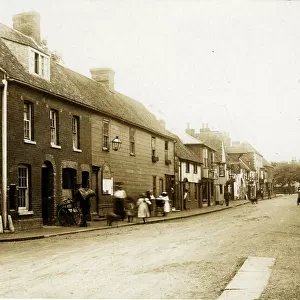
Home > Europe > United Kingdom > England > Kent > Broad Street
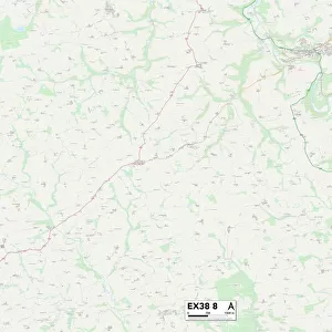
Exeter EX15 3 Map

![]()
Wall Art and Photo Gifts from Map Marketing
Exeter EX15 3 Map
Postcode Sector Map of Exeter EX15 3
Media ID 19970105
Appletree Close Ashley Close Ashley Road Black Lane Bramley Way Bridge Street Castle Park Chapel Hill Clarke Close Clay Lane Coldharbour College Green Commercial Road Cornhill Coronation Crescent East Mead East Street Eastlands Exeter Fore Street Grays Lane Great Meadow Griffin Close High Street Hunters Hill Hunters Way Jubilee Drive Longmead Manor Close Meadow View Mill Street Orchard Close Orchard Way Parklands Portway Prospect Crescent Red Lane Redwood Close Riverside Rosemary Lane Russet Close Shepherds Lane Silver Street Southview St Margarets Close Station Road Summer Close The Oaks The Spinney The Square The Strand Town Hill Woodgate Churchills Craddock Highland Park Markers Northcott Prescott
FEATURES IN THESE COLLECTIONS
> Europe
> United Kingdom
> England
> Kent
> Ashley
> Europe
> United Kingdom
> England
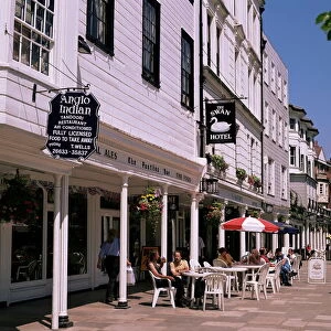
> Kent
> Bridge
> Europe
> United Kingdom
> England
> Kent
> Broad Street
> Europe
> United Kingdom
> England
> Kent
> Brook Street
> Europe
> United Kingdom
> England
> Kent
> Brook
> Europe
> United Kingdom
> England
> Kent
> Green Street Green
> Europe
> United Kingdom
> England
> Kent
> High Street
> Europe
> United Kingdom
> England
> Kent
> Kent Street
> Europe
> United Kingdom
> England
> Kent
> Lower Green
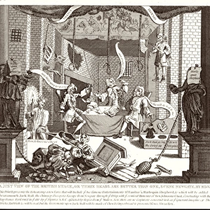
> Historic
> Battles
> Related Images
> Map Marketing
> Postcode Sector Maps
> EX - Exeter
MADE IN THE USA
Safe Shipping with 30 Day Money Back Guarantee
FREE PERSONALISATION*
We are proud to offer a range of customisation features including Personalised Captions, Color Filters and Picture Zoom Tools
SECURE PAYMENTS
We happily accept a wide range of payment options so you can pay for the things you need in the way that is most convenient for you
* Options may vary by product and licensing agreement. Zoomed Pictures can be adjusted in the Cart.