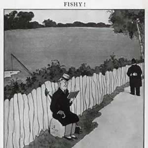
Home > Animals > Fishes > P > Poacher
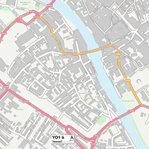
York YO8 6 Map

![]()
Wall Art and Photo Gifts from Map Marketing
York YO8 6 Map
Postcode Sector Map of York YO8 6
Media ID 19983110
Back Lane Badgers Way Bell Lane Carr Close Carr Lane Chapel Lane Chestnut Avenue Chestnut Court Chestnut Drive Chestnut Rise Church Close Church Street Church View Clay Lane Dead Lane Durham Close Ferry Lane Finkle Street Grange Road Green Lane Greengate Lane Hagg Lane Hall Lane Haw Lane Highfield Highfield Grove Highfield Road Hull Road Ings Road Landing Lane Main Street Manor Close Manor Court Meadowfield Meadowfield Drive Middle Lane Mill Garth Mill Lane Millfield Road Moor Lane Mulberry Gardens Northfield Road Nursery Close Oak Tree Court Oakfield Lane Orchard Close Orchard End Sand Lane School Road Southlands Spire View St Marys Avenue Station Lane Station Road Station View Street Lane The Cloisters The Hedgerows The Maltings Vicarage Close Villa Close Water Lane Waterside Westfield Lane Willow View Woodhall Lane York York Road Cliffe Lund Woodhall
FEATURES IN THESE COLLECTIONS
> Animals
> Fishes
> P
> Poacher
> Animals
> Mammals
> Mustelidae
> Honey Badger
> Arts
> Artists
> W
> William White
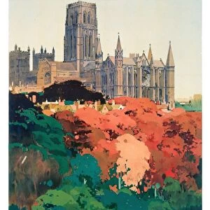
> Europe
> United Kingdom
> England
> Durham
> Durham
> Europe
> United Kingdom
> England
> Durham
> Grange Villa
> Europe
> United Kingdom
> England
> Durham
> South Moor
> Map Marketing
> Postcode Sector Maps
> YO - York
> Maps and Charts
> Related Images
MADE IN THE USA
Safe Shipping with 30 Day Money Back Guarantee
FREE PERSONALISATION*
We are proud to offer a range of customisation features including Personalised Captions, Color Filters and Picture Zoom Tools
SECURE PAYMENTS
We happily accept a wide range of payment options so you can pay for the things you need in the way that is most convenient for you
* Options may vary by product and licensing agreement. Zoomed Pictures can be adjusted in the Cart.