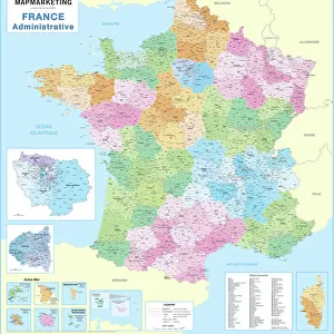
Home > Europe > France > Paris > Maps
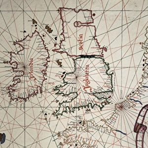
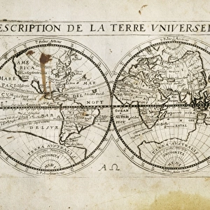
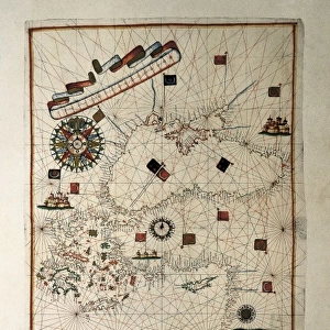
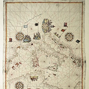
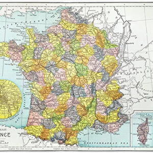
The Caverio Map or Caveri Map, circa 1505. This

![]()
Wall Art and Photo Gifts from Mary Evans Picture Library
The Caverio Map or Caveri Map, circa 1505. This
The Caverio Map or Caveri Map, circa 1505. This map was one of the primary sources used to make the Waldseem� map. Miniature Painting. FRANCE. Paris. National Library
Mary Evans Picture Library makes available wonderful images created for people to enjoy over the centuries
Media ID 8282169
© Mary Evans Picture Library 2015 - https://copyrighthub.org/s0/hub1/creation/maryevans/MaryEvansPictureID/10682011
Illuminated Manuscript Manuscripts Miniatures Primary Sources Nicolay
FEATURES IN THESE COLLECTIONS
> Europe
> France
> Paris
> Maps
> Europe
> France
> Paris
> Related Images
> Maps and Charts
> Related Images
EDITORS COMMENTS
1. Title: The Caverio Map, Circa 1505: A Glimpse into Early Cartography and Manuscript Illumination The Caverio Map, also known as the Caveri Map, is an exquisite example of early cartography and manuscript illumination, dating back to approximately 1505. This intricately detailed and beautifully colored miniature painting is currently housed in the National Library of France in Paris. As one of the primary sources used to create the renowned Waldseemüller map, the Caverio Map holds significant historical importance. The Waldseemüller map, produced in 1507, is considered the first map to depict the Americas with the names "America" and "New World." The Caverio Map showcases an impressive level of detail, with various geographical features, including rivers, mountains, and coastlines, meticulously rendered. The map is horizontal in orientation, and its vibrant colors and illuminated elements add a striking visual appeal. The map's creation was likely influenced by the extensive travel and exploration of the late 15th and early 16th centuries. The Caverio Map reflects the contemporary understanding of the world at that time, with some inaccuracies and misconceptions that were common during the era. This magnificent manuscript is a testament to the artistic and cartographic achievements of the period. Its intricate details and historical significance make it an essential piece in the study of early cartography and manuscript illumination. The Caverio Map continues to captivate scholars, historians, and enthusiasts alike, offering a fascinating glimpse into the world of exploration and discovery during the Renaissance era.
MADE IN THE USA
Safe Shipping with 30 Day Money Back Guarantee
FREE PERSONALISATION*
We are proud to offer a range of customisation features including Personalised Captions, Color Filters and Picture Zoom Tools
SECURE PAYMENTS
We happily accept a wide range of payment options so you can pay for the things you need in the way that is most convenient for you
* Options may vary by product and licensing agreement. Zoomed Pictures can be adjusted in the Cart.