Home > Europe > United Kingdom > England > Manchester > Salford
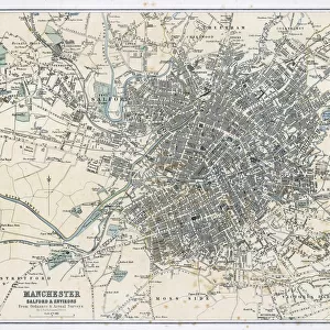
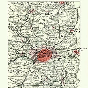
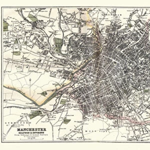
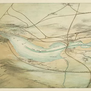
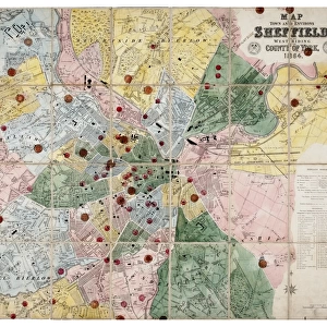
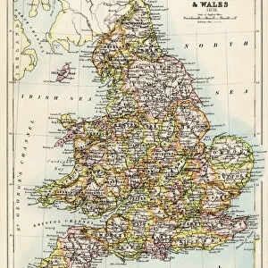
Old Map of Manchester and Salford 1898 from the Royal Atlas by Bartholomew

![]()
Wall Art and Photo Gifts from MapSeeker
Old Map of Manchester and Salford 1898 from the Royal Atlas by Bartholomew
A fine very detailed plan of the City of Manchester and Salford remastered from an original contained within " The Royal Atlas of England and Wales" ; edited by J.G. Bartholomew, published by George Newnes, Limited, London
Welcome to the Mapseeker Image library and enter an historic gateway to one of the largest on-line collections of Historic Maps, Nostalgic Views, Vista's and Panorama's from a World gone by.
Media ID 20347783
Bartholomew Bartholomew Map Historic Map Old Town Plan Royal Atlas Royal Atlas Map City Of Manchester Manchester Manchester City Salford
FEATURES IN THESE COLLECTIONS
> Arts
> Photorealistic artworks
> Detailed art pieces
> Masterful detailing in art
> Europe
> United Kingdom
> England
> London
> Royalty
> Europe
> United Kingdom
> England
> Manchester
> Manchester
> Europe
> United Kingdom
> England
> Manchester
> Salford
> Europe
> United Kingdom
> England
> Maps
> Europe
> United Kingdom
> England
> Salford
> Europe
> United Kingdom
> Wales
> Maps
> Europe
> United Kingdom
> Wales
> Posters
> Maps and Charts
> Related Images
> Maps and Charts
> Wales
> MapSeeker
> British Town And City Plans
> English & Welsh PORTFOLIO
EDITORS COMMENTS
This beautifully preserved print showcases the "Old Map of Manchester and Salford 1898" from the esteemed Royal Atlas by Bartholomew. A true treasure for history enthusiasts, this fine and incredibly detailed plan offers a glimpse into the past, capturing the essence of these bustling cities in their earlier years. Remastered from an original found within "The Royal Atlas of England and Wales" edited by J. G. Bartholomew and published by George Newnes, Limited in London, this map holds immense historical significance. It provides a captivating visual representation of Manchester's urban landscape during a time when it was rapidly evolving. With its intricate cartography and meticulous attention to detail, this old town plan transports us back to an era long gone but not forgotten. The streets are lined with charming buildings that have witnessed countless stories unfold over the years. As we explore this historic map, we can't help but marvel at how much has changed since 1898. From major landmarks to smaller neighborhoods, every corner tells a tale of growth and transformation. Whether you're a proud Mancunian or simply fascinated by history, this royal atlas map is sure to captivate your imagination as you trace the footsteps of those who walked these streets generations ago. It serves as both a testament to our shared heritage and a reminder that even amidst progress, traces of our past continue to shape our present-day cityscape.
MADE IN THE USA
Safe Shipping with 30 Day Money Back Guarantee
FREE PERSONALISATION*
We are proud to offer a range of customisation features including Personalised Captions, Color Filters and Picture Zoom Tools
SECURE PAYMENTS
We happily accept a wide range of payment options so you can pay for the things you need in the way that is most convenient for you
* Options may vary by product and licensing agreement. Zoomed Pictures can be adjusted in the Cart.