Home > Europe > United Kingdom > England > London > Boroughs > Bexley
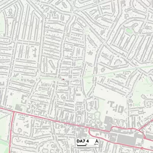
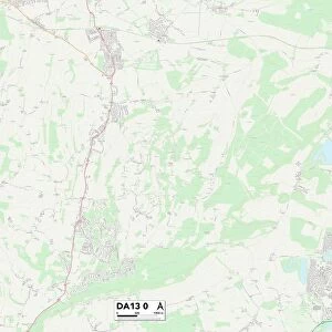
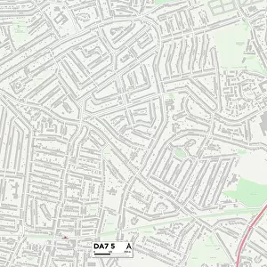
Bexley DA7 5 Map

![]()
Wall Art and Photo Gifts from Map Marketing
Bexley DA7 5 Map
Postcode Sector Map of Bexley DA7 5
Media ID 19968650
Ambleside Road Arnside Road Ashbourne Avenue Barry Avenue Bexley Bowness Road Cartmel Road Cranbrook Road Cumberland Drive Ennerdale Road Eskdale Road First Avenue Francis Avenue Franklin Road Keswick Road Kipling Road Knowle Avenue Lansdowne Avenue Long Lane Malvern Avenue Mark Close Norfolk Gardens Oakhurst Gardens Pembury Road Penshurst Road Shakespeare Road Stapleton Road The Green The Quadrant Westbourne Road Whitfield Road The Pantiles
FEATURES IN THESE COLLECTIONS
> Animals
> Mammals
> Muridae
> Heath Mouse
> Europe
> United Kingdom
> England
> Cumberland
> Europe
> United Kingdom
> England
> London
> Boroughs
> Bexley
> Europe
> United Kingdom
> England
> Norfolk
> Keswick
> Europe
> United Kingdom
> England
> Norfolk
> Related Images
> Europe
> United Kingdom
> Wales
> Powys
> Related Images
> Europe
> United Kingdom
> Wales
> South Glamorgan
> Barry
> Map Marketing
> Postcode Sector Maps
> DA - Dartford
> Maps and Charts
> Related Images
MADE IN THE USA
Safe Shipping with 30 Day Money Back Guarantee
FREE PERSONALISATION*
We are proud to offer a range of customisation features including Personalised Captions, Color Filters and Picture Zoom Tools
SECURE PAYMENTS
We happily accept a wide range of payment options so you can pay for the things you need in the way that is most convenient for you
* Options may vary by product and licensing agreement. Zoomed Pictures can be adjusted in the Cart.