Home > Europe > United Kingdom > England > Lancashire > Church
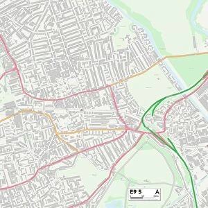
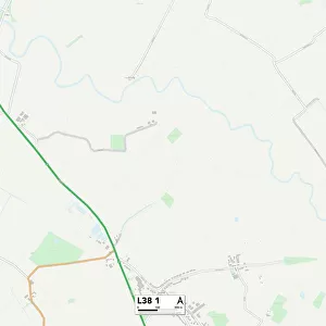
West Lancashire L39 1 Map

![]()
Wall Art and Photo Gifts from Map Marketing
West Lancashire L39 1 Map
Postcode Sector Map of West Lancashire L39 1
Media ID 19973613
Brookhouse Road Church Fields County Road Dawson Road Douglas Drive Fairfield Close Fairfield Drive Green Lane Hayfield Road Highfield Road Hillcrest Road Jubilee Avenue Ludlow Drive Rutland Crescent Scott Drive Shelley Drive Southport Road The Avenue West Lancashire Yew Tree Road
FEATURES IN THESE COLLECTIONS
> Europe
> United Kingdom
> England
> Lancashire
> Church
> Europe
> United Kingdom
> England
> Lancashire
> Lea
> Europe
> United Kingdom
> England
> Lancashire
> Related Images
> Europe
> United Kingdom
> England
> Lancashire
> Scarisbrick
> Europe
> United Kingdom
> England
> Lancashire
> Street
> Europe
> United Kingdom
> England
> Rutland
> Related Images
> Map Marketing
> Postcode Sector Maps
> L - Liverpool
> Maps and Charts
> Related Images
MADE IN THE USA
Safe Shipping with 30 Day Money Back Guarantee
FREE PERSONALISATION*
We are proud to offer a range of customisation features including Personalised Captions, Color Filters and Picture Zoom Tools
SECURE PAYMENTS
We happily accept a wide range of payment options so you can pay for the things you need in the way that is most convenient for you
* Options may vary by product and licensing agreement. Zoomed Pictures can be adjusted in the Cart.