Home > South America > French Guiana > Maps
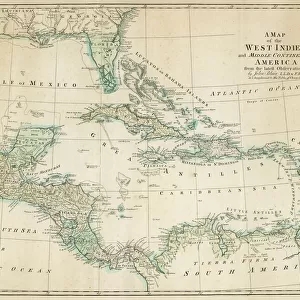
West Indies and Caribbean Map

![]()
Wall Art and Photo Gifts from Map Marketing
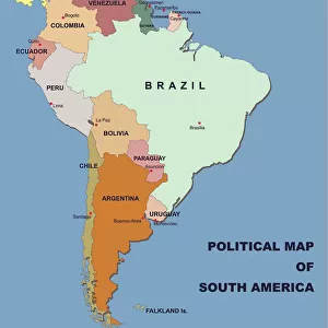
West Indies and Caribbean Map
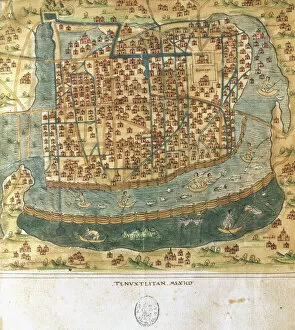
This Caribbean map covers an area from Dallas in the north to Esmeraldes in the south and from Mexico City in the west to French Guiana in the east. The map also includes insets of the Windward and Leeward islands. The map features political country colouring and towns/cities are marked in four population bands. Capital cities are also clearly marked
Media ID 19951711
© Map Marketing Ltd
FEATURES IN THESE COLLECTIONS
> Maps and Charts
> Related Images
> North America
> Mexico
> Maps
> North America
> Mexico
> Mexico City
> North America
> Mexico
> Related Images
> Popular Themes
> North Island
> South America
> French Guiana
> Maps
> South America
> French Guiana
> Related Images
MADE IN THE USA
Safe Shipping with 30 Day Money Back Guarantee
FREE PERSONALISATION*
We are proud to offer a range of customisation features including Personalised Captions, Color Filters and Picture Zoom Tools
SECURE PAYMENTS
We happily accept a wide range of payment options so you can pay for the things you need in the way that is most convenient for you
* Options may vary by product and licensing agreement. Zoomed Pictures can be adjusted in the Cart.