Home > Europe > United Kingdom > England > London > Sights > Regents Park
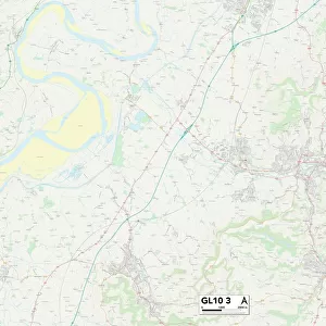
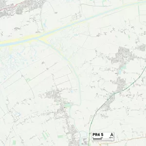
Chorley PR7 6 Map

![]()
Wall Art and Photo Gifts from Map Marketing
Chorley PR7 6 Map
Postcode Sector Map of Chorley PR7 6
Media ID 19976686
Ambleside Avenue Apple Tree Close Badgers Walk Barons Way Beech Avenue Belfry Close Birch Avenue Birkdale Close Briar Avenue Brookside Carnoustie Drive Cedar Avenue Chestnut Avenue Chiltern Avenue Chorley Church Walk Columbine Close Coniston Avenue Conway Close Cotswold Avenue Dale Avenue Earls Way East Terrace Gleneagles Drive Grange Drive Grasmere Close Greenside Hillside Close Houghton Close Kingsway Laurel Avenue Limes Avenue Lomond Close Lydiate Lane Meadowcroft Mill Lane Mimosa Close Muirfield Close New Lane Northside Oak Avenue Old School Lane Orchard Close Park Avenue Pear Tree Lane Poplar Avenue Princess Way Queensway Regency Gardens Regents Way Rose Hill School Lane Southport Road Southside Springfield Gardens St Andrews Close St Marys Gate Sycamore Avenue Talbot Drive The Croft Tithe Barn Lane Troon Close Vicarage Close Wentworth Drive West Way Wigan Road Woodside Yew Tree Avenue
FEATURES IN THESE COLLECTIONS
> Europe
> United Kingdom
> England
> London
> Sights
> Regents Park
> Europe
> United Kingdom
> Scotland
> Angus
> Carnoustie
> Europe
> United Kingdom
> Scotland
> Fife
> St Andrews
> Europe
> United Kingdom
> Scotland
> Strathclyde
> Troon
> Map Marketing
> Postcode Sector Maps
> PR - Preston
> Maps and Charts
> Related Images
MADE IN THE USA
Safe Shipping with 30 Day Money Back Guarantee
FREE PERSONALISATION*
We are proud to offer a range of customisation features including Personalised Captions, Color Filters and Picture Zoom Tools
SECURE PAYMENTS
We happily accept a wide range of payment options so you can pay for the things you need in the way that is most convenient for you
* Options may vary by product and licensing agreement. Zoomed Pictures can be adjusted in the Cart.